Los Angeles Map (National Geographic Destination City Map)
Rand McNally United States Interstate Fold Map Map – Folded Map, March 1, 2024
Rand McNally Midsize Easy to Read Road Atlas 2025
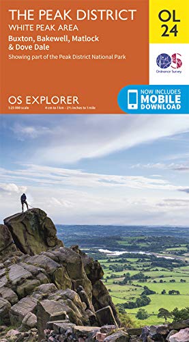
The Peak District: White Peak Area Map | Peak District National Park | Ordnance Survey | OS Explorer Map OL 24 | England | Walks | Hiking | Maps | Adventure Map – Folded Map, 17 Feb. 2020
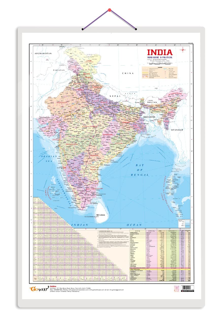
Indian Road Guide & Political Map Charts with Big font and Dust resistant Lamination | 300 GSM Recyclable Charts
Maps: Aleksandra Mizielinska - Daniel Mizielinski
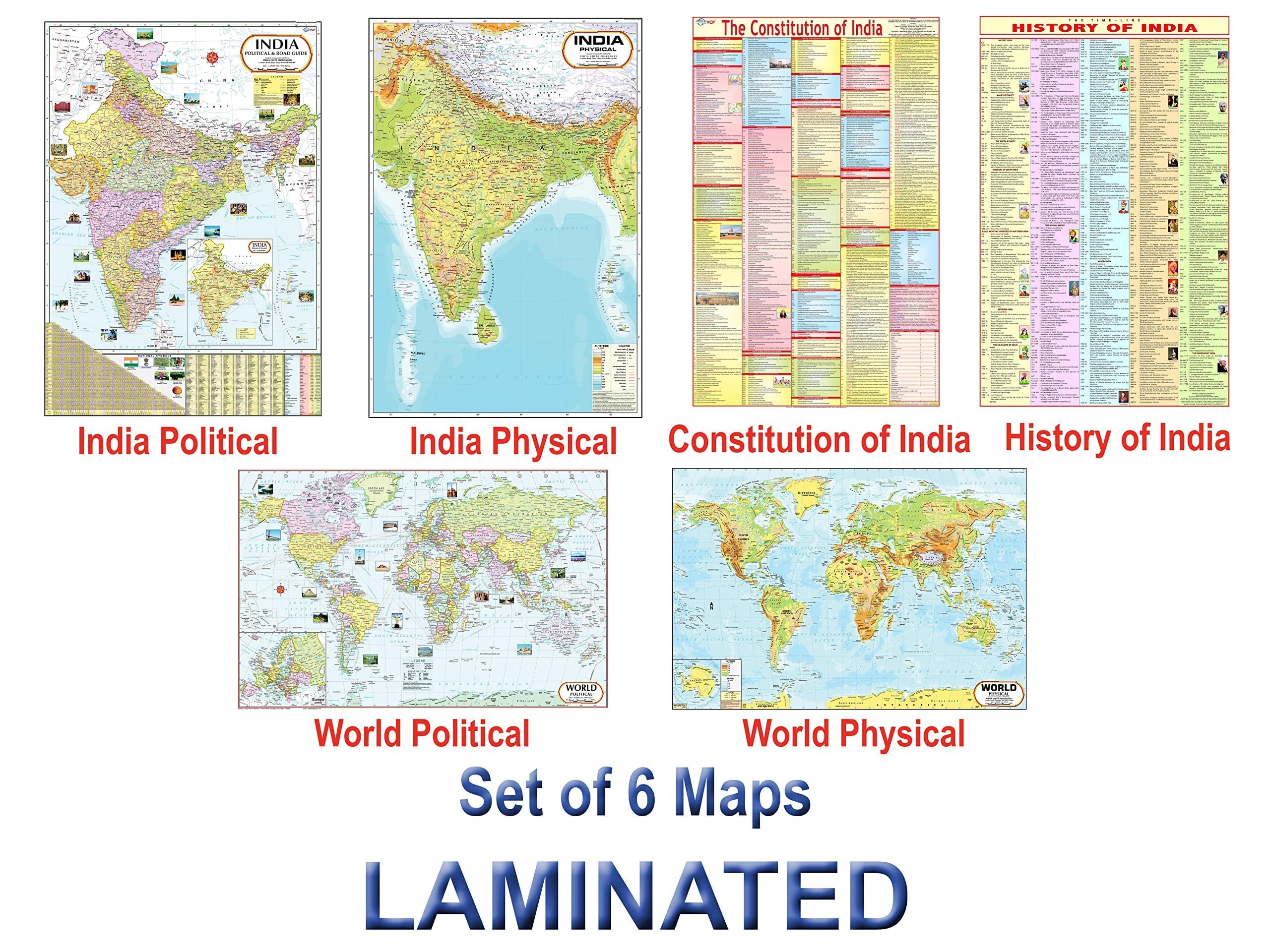
India & World Map ( Both Political & Physical ) with Constitution of India and History of India Chart | LAMINATED SET OF 6 Maps & Charts | Useful for UPSC, SSC, IES and other competitive exams
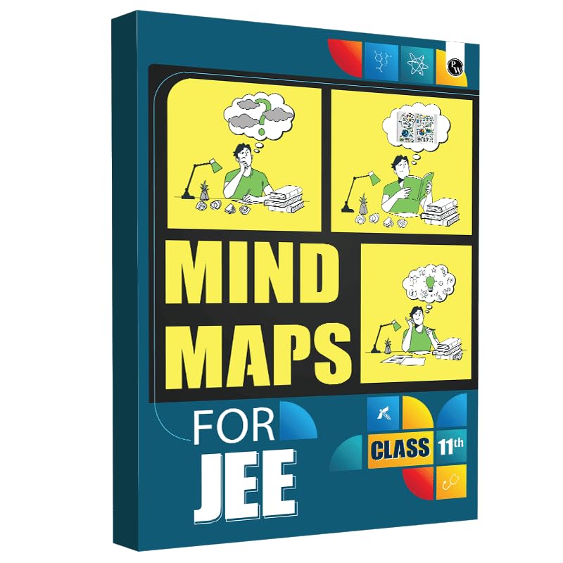
PW JEE Mind Maps for Class 11th Complete Coverage of Physics, Chemistry and Mathematics | Interactive, Important Concept & Formula 2024-2025 (Paperback) Unknown Binding – 16 May 2023
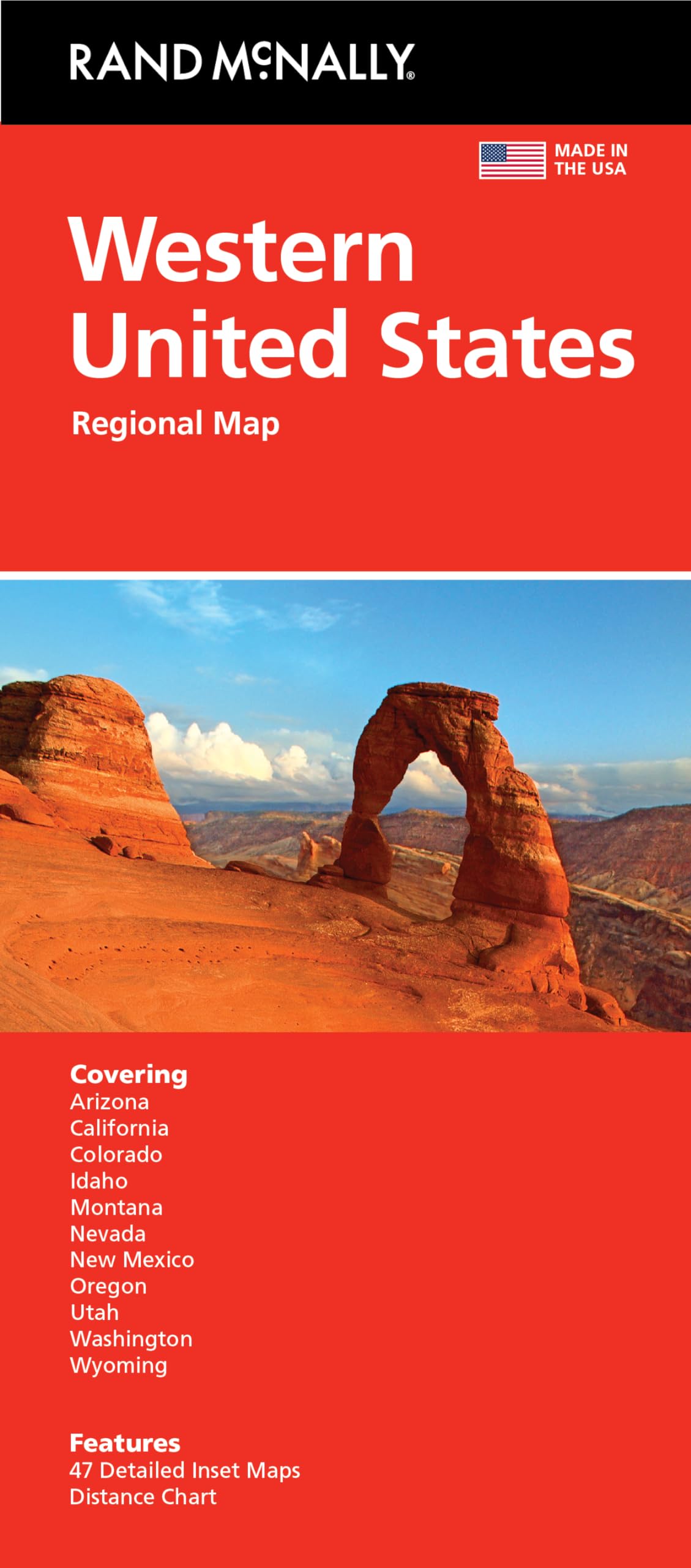
Rand McNally Folded Map: Western United States
The English Lakes: South-Eastern Area Map | Windermere, Kendal & Silverdale | Ordnance Survey | OS Explorer Map OL7 | England | Walks | Hiking | Maps | Adventure
National Geographic Road Atlas 2025: Scenic Drives Edition [United States, Canada, Mexico] (National Geographic Recreation Atlas)
National Geographic Road Atlas 2025: Adventure Edition [United States, Canada, Mexico] Spiral-bound – June 10, 2024
Rand McNally Classic Edition World Wall Map – Laminated Rolled Map – December 3, 2021
Scotland Map | Trip Planning | Ordnance Survey | OS Tour Map | Scottish Attractions | Scenic Routes | National Parks | Maps | Adventure
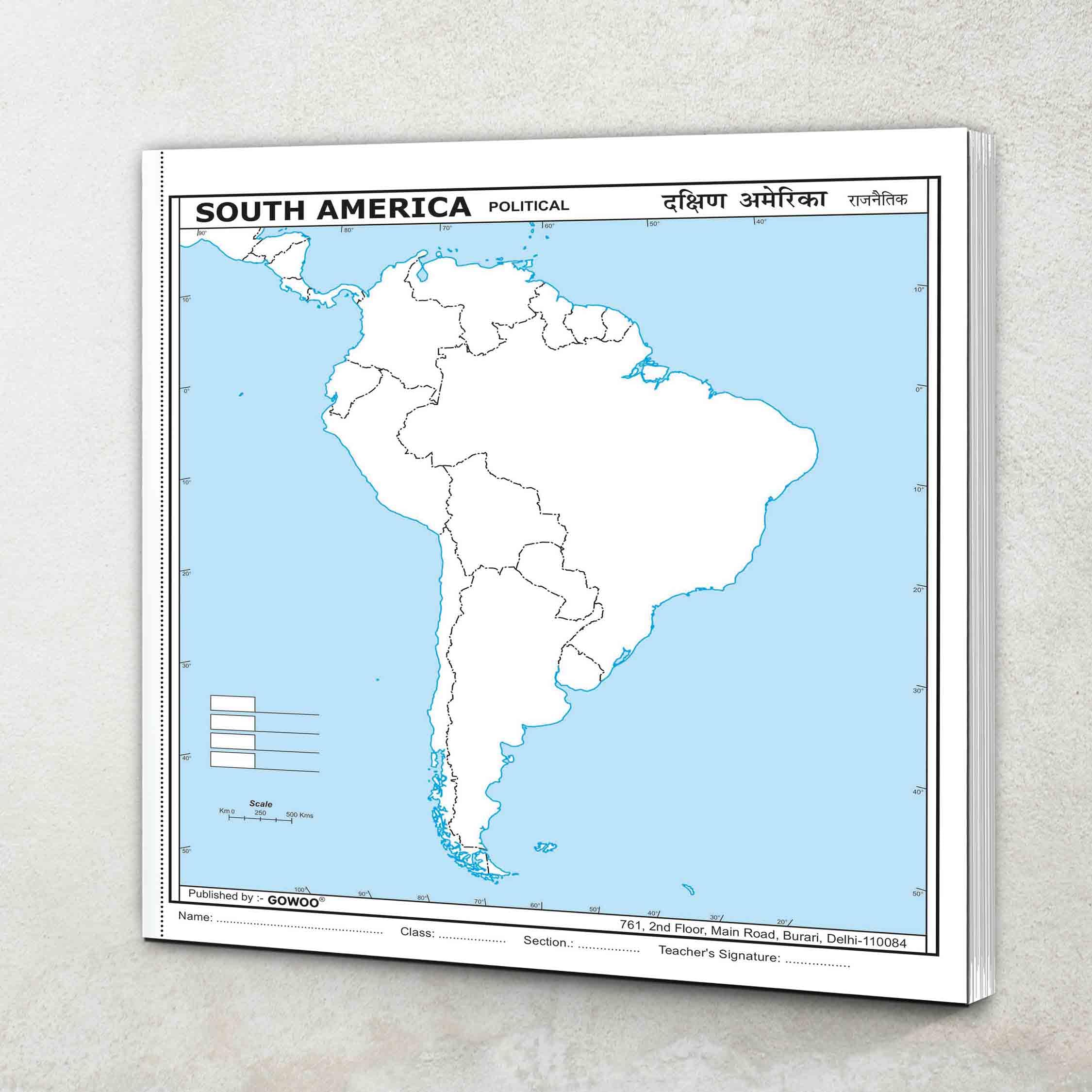
SMALL - 100 SOUTH AMERICA POLITICAL OUTLINE MAP FOR SCHOOL|South America political map for school
Yorkshire Dales Map | Southern & Western | Ordnance Survey | OS Explorer Map OL2 | England | Walks | Hiking | Maps | Adventure: OL02
PW JEE Mind Maps for Class 12th | Complete Coverage of Physics, Chemistry and Mathematics | Interactive, Important Concept & Formula 2024-2025 (Paperback)
Snowdon / Yr Wyddfa Map | Conwy Valley / Dyffryn Conwy | Ordnance Survey | OS Explorer Map OL 17 | Wales | Walks | Hiking | Maps | Adventure
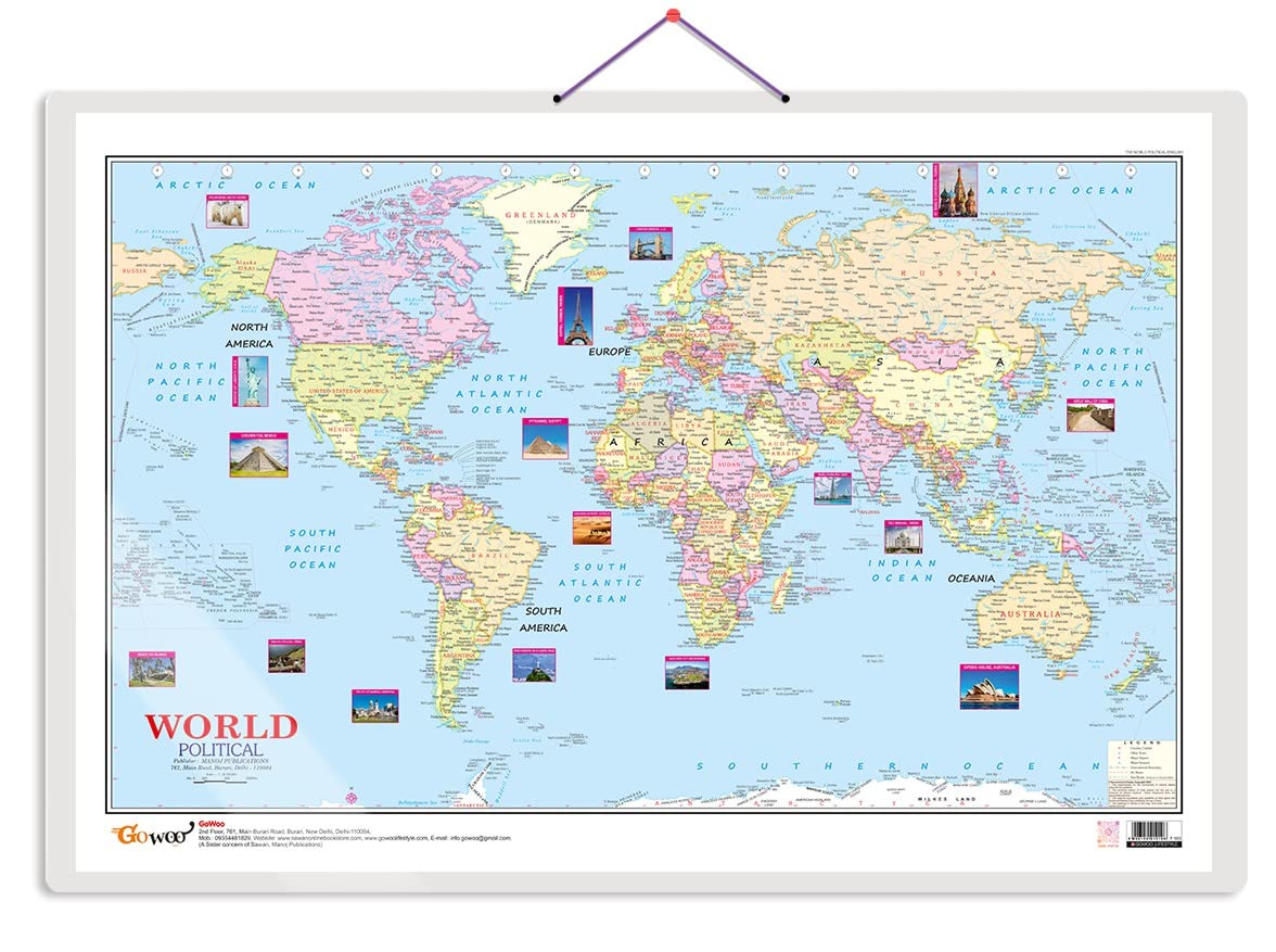
World Political Map Charts with Big font and Dust resistant Lamination | 300 GSM Recyclable Charts
2025 Collins Handy Road Atlas Britain and Ireland: A5 Spiral (Collins Road Atlas)
Rose Book of Bible Charts, Maps, and Time Lines
Map by Map Series 3 Books Collection Set (Battles, History of the World & World War II) DK Hardcover – 20 Sept. 2023
India & World Map ( Both Political & Physical ) with Constitution of India Chart | LAMINATED | SET OF 5 | Useful for UPSC, SSC, IES and other competitive exams
The Map Store 3D Pine Orange Yellow Wooden World Map | Wooden World Map For Wall | Office Decor | Premiere Home Decor Art | Wall Hanging | Office Decor (Prime, L - 60" X 36")
World Map (140 x 100 cm) Laminated (Big Map) Map – Wall Map, 1 January 2016
Momo & Nashi United States & World Map Poster for Kids - 2 Pc - 24 x 16 Inch Waterproof USA & Map of the World Poster - for Wall Posters for Learning, Classroom, Education, Back to School Resources
India Map (100 x 140 cm) Laminated (Big Map) -With New Union Territories of Jammu & Kashmir and Ladakh Multicolour
Great Maps: The World's Masterpieces Explored and Explained (DK History Changers)
MAHARASHTRA MAP cm (40"x28" inch). Updated Map With Important Fact and Figure. Ideal Map for UPSC, PCS, SSC, RAILWAY'S Exams, State Exams and Other Competitive Exams. Stationery – 30 September 2021
Discover India - A Travel Map
Rand McNally 2025 Road Atlas & National Park Guide


![National Geographic Road Atlas 2025: Scenic Drives Edition [United States, Canada, Mexico] (National Geographic Recreation Atlas)](https://m.media-amazon.com/images/I/814R4OsGtCL.jpg)
![National Geographic Road Atlas 2025: Adventure Edition [United States, Canada, Mexico] Spiral-bound – June 10, 2024](https://m.media-amazon.com/images/I/81rRihqWqgL.jpg)